Castelo is located in the south of Espírito Santo. Surrounded by mountains and waterfalls, it has a mild climate, which varies between 23º and 5º in winter. Its population is formed mostly by descendants of Italians.
Distant 146 kilometers from the state capital, Vitória, and 36 kilometers from Cachoeiro de Itapemirim, Castelo can be reached by Highways ES 166, ES 379 and ES 491 and BR 482, departing from Cachoeiro, with access at the Two Barras interchange , along the Fued Nemer highway, on a journey of 18 kilometers.
Access is also possible from Venda Nova do Imigrante. Leaving from Vitória, taking the BR 262 road, you arrive at Venda Nova do Imigrante and from there, through the Pedro Cola Highway, you arrive at Castelo (36 km).
Neighboring municipalities
To the South – Cachoeiro de Itapemirim
To the North – Conceição de Castelo and Venda Nova do Imigrante
To the East – Domingos Martins and Vargem Alta
To the West – Muniz Freire and Alegre
Districts
Estrela do Norte, Limoeiro, Montepio, Heritage of Gold, Pontoons.
Hydrography
The springs are born at the top of several mountains and descend to the seat of the municipality, forming the two main rivers that cross the city, Caxixe and Castelo. Although they were once navigable, the volume of water has greatly decreased, making them non-navigable.
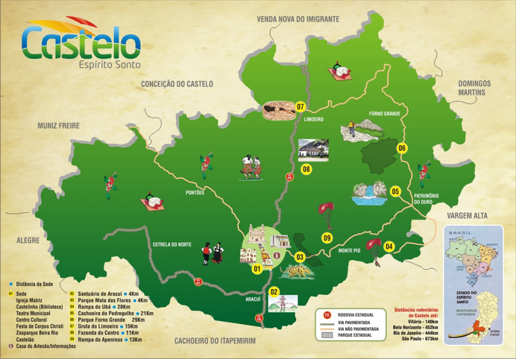
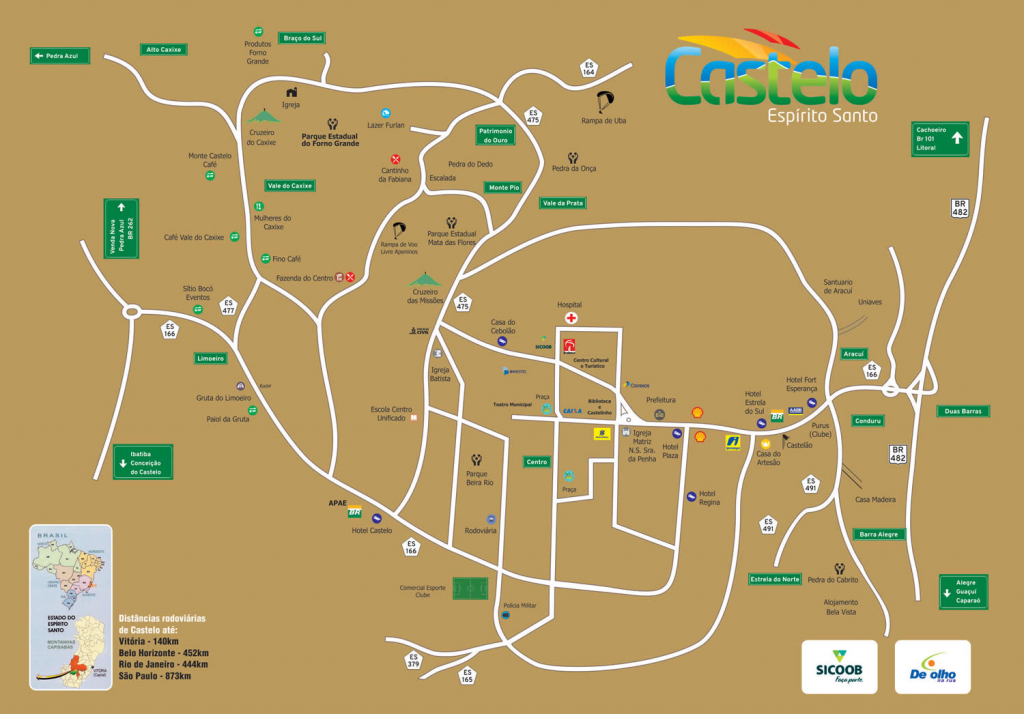
Tourist Map: